Complete Guide to Amami Oshima:
Spectacular Nature & Island Cuisine
World Heritage forests and coral reef seas.
To the “Galapagos of the Orient” where untouched nature remains.
An extraordinary island experience that will awaken all your senses awaits.
Island of World Natural Heritage
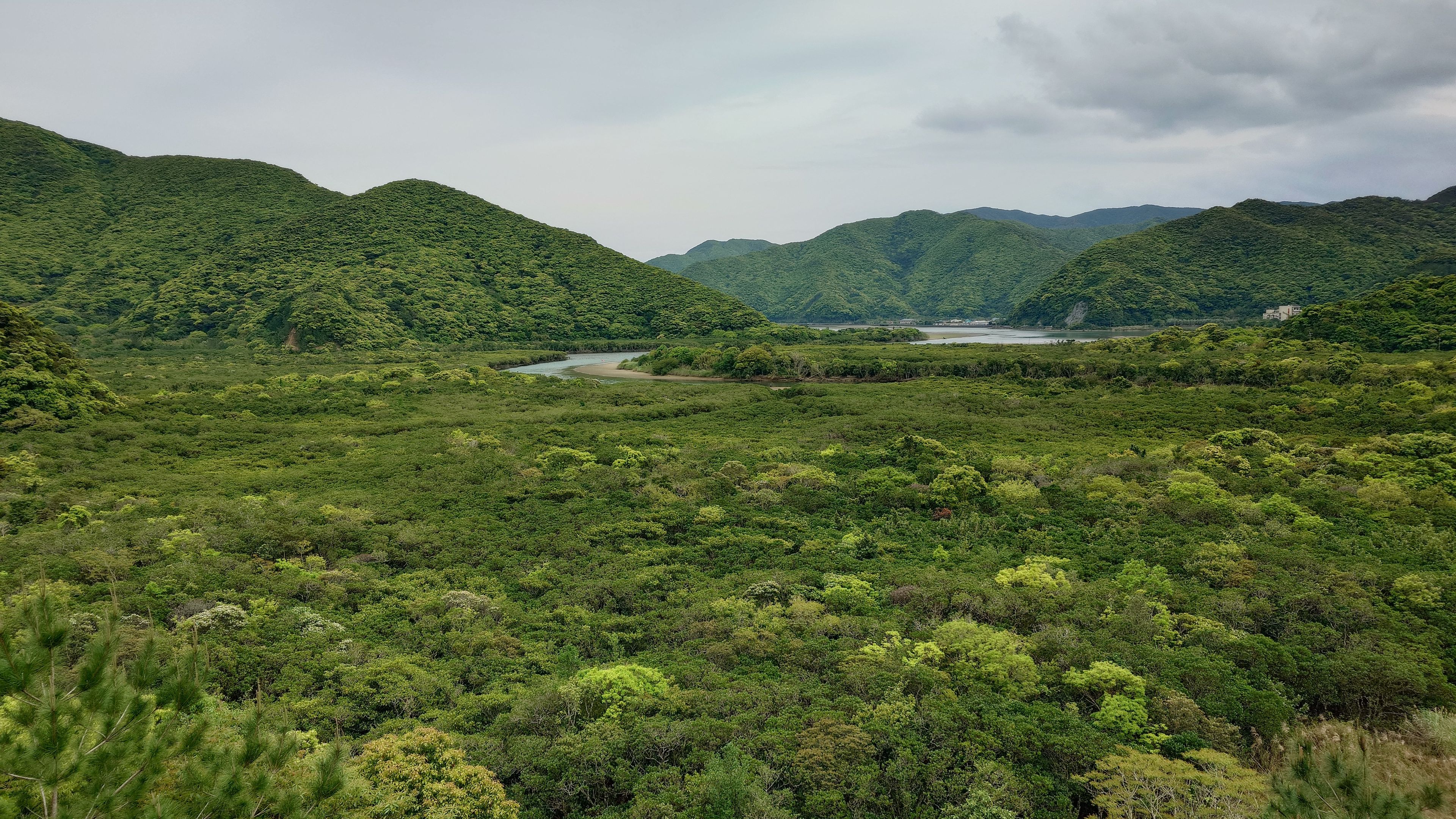
What made this registration possible is the subtropical evergreen broadleaf forest that covers approximately 70% of the island's area.
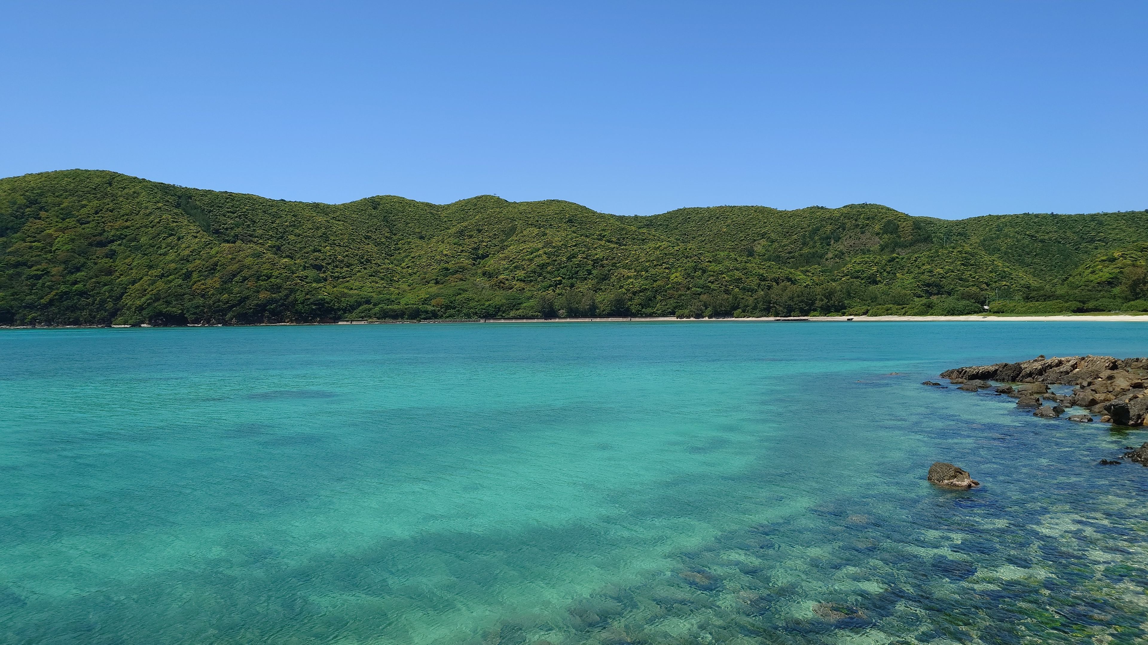
The view from Kochi-yama Viewpoint vividly conveys the density of this forest.
Waves of deep green press in from below, with the ridgeline of Kakeroma Island floating in the distance.
The untouched forests are so dark, so dense, so silent.
Amami rabbit, Lidth's jay, Amami Ishikawa's frog—the sheer abundance of endemic species stands as testament to evolution shaped by millennia of isolation.
While you may spot Amami rabbits along the road during a night drive, slow driving is strictly required on mountain roads to prevent roadkill.
💡 Travel Tips
🐇 Encounters with Endemic Species
Lidth’s Jay: High probability of sighting throughout the island during the day.
Amami Rabbit: May be encountered by driving slowly on mountain roads toward Uken or Yamato villages at night. Observe quietly without using flash.
🌿 Heritage Area Etiquette
Kinsakubaru Primeval Forest: Participation in a guided tour is mandatory for heritage protection (advance booking required, fee applies).
Entering areas off the designated course is strictly prohibited.
Kuroshio Forest Mangrove Park
From the viewpoint at Kuroshio Forest Mangrove Park, you can take in the entire panorama where waterways and canopy intricately intertwine.
The view changes completely when you paddle out into the channels by canoe.
The narrow passages where breathing roots (pneumatophores) rise from the water offer a scale unimaginable from the viewpoint. Advance booking for tours is recommended.
The forest's appearance differs significantly between low and high tides. Don't forget to check the tide levels before your visit.
🛶 Canoe Tour Bookings
Canoe tours fill up fast during peak season (July–August). Once your dates are set, book early.
▼ Check availability & prices (subject to change)
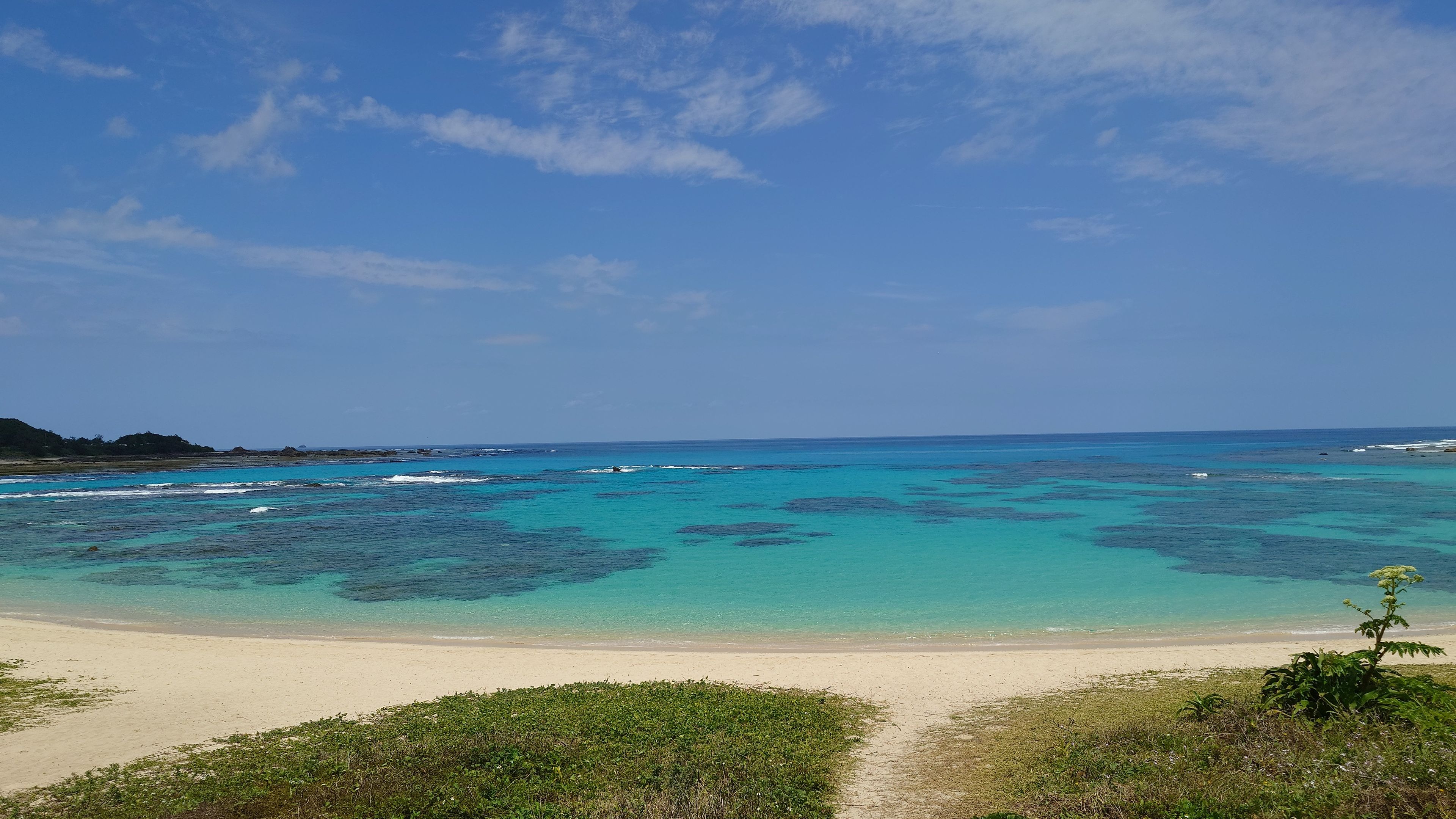
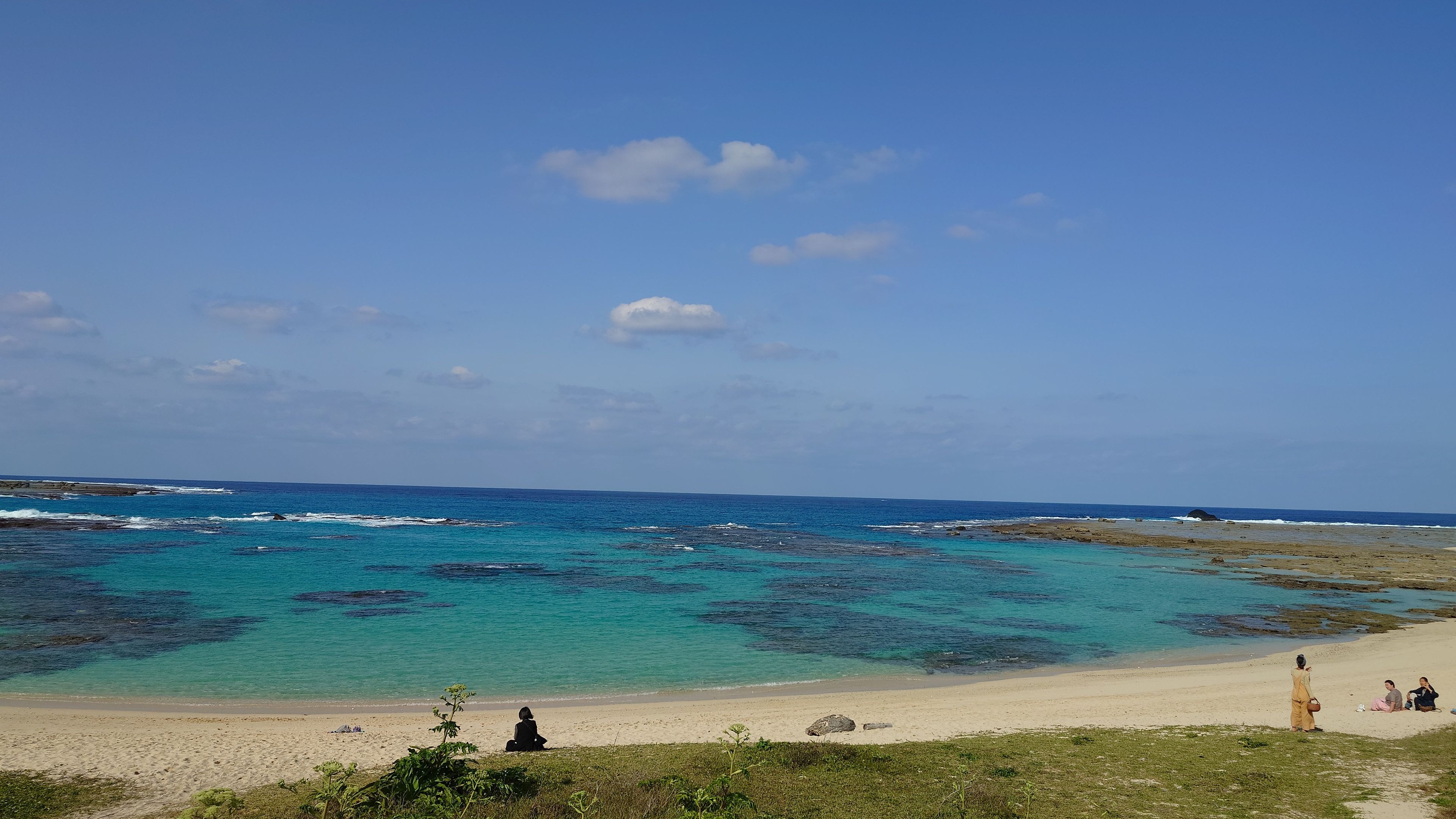
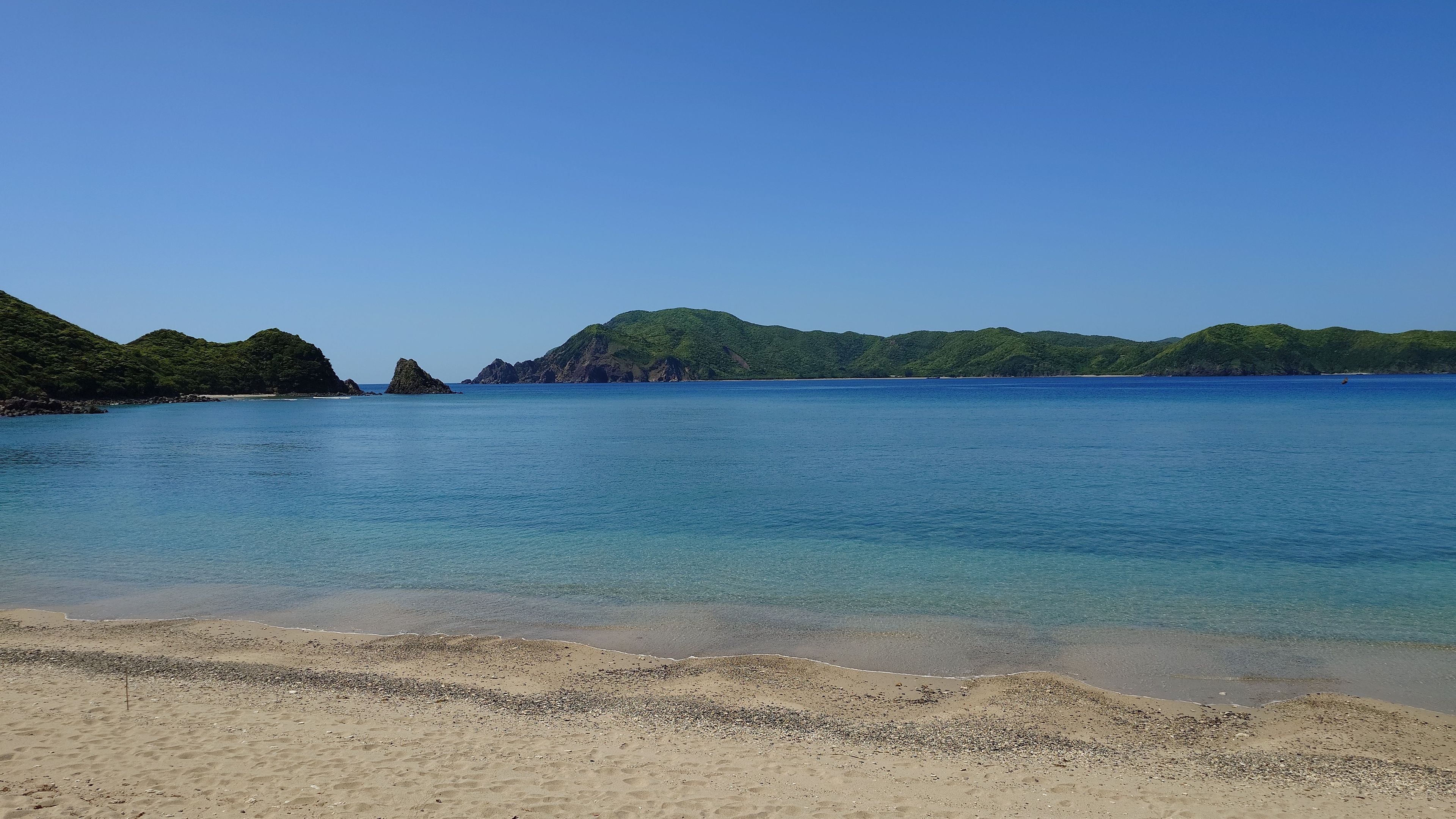
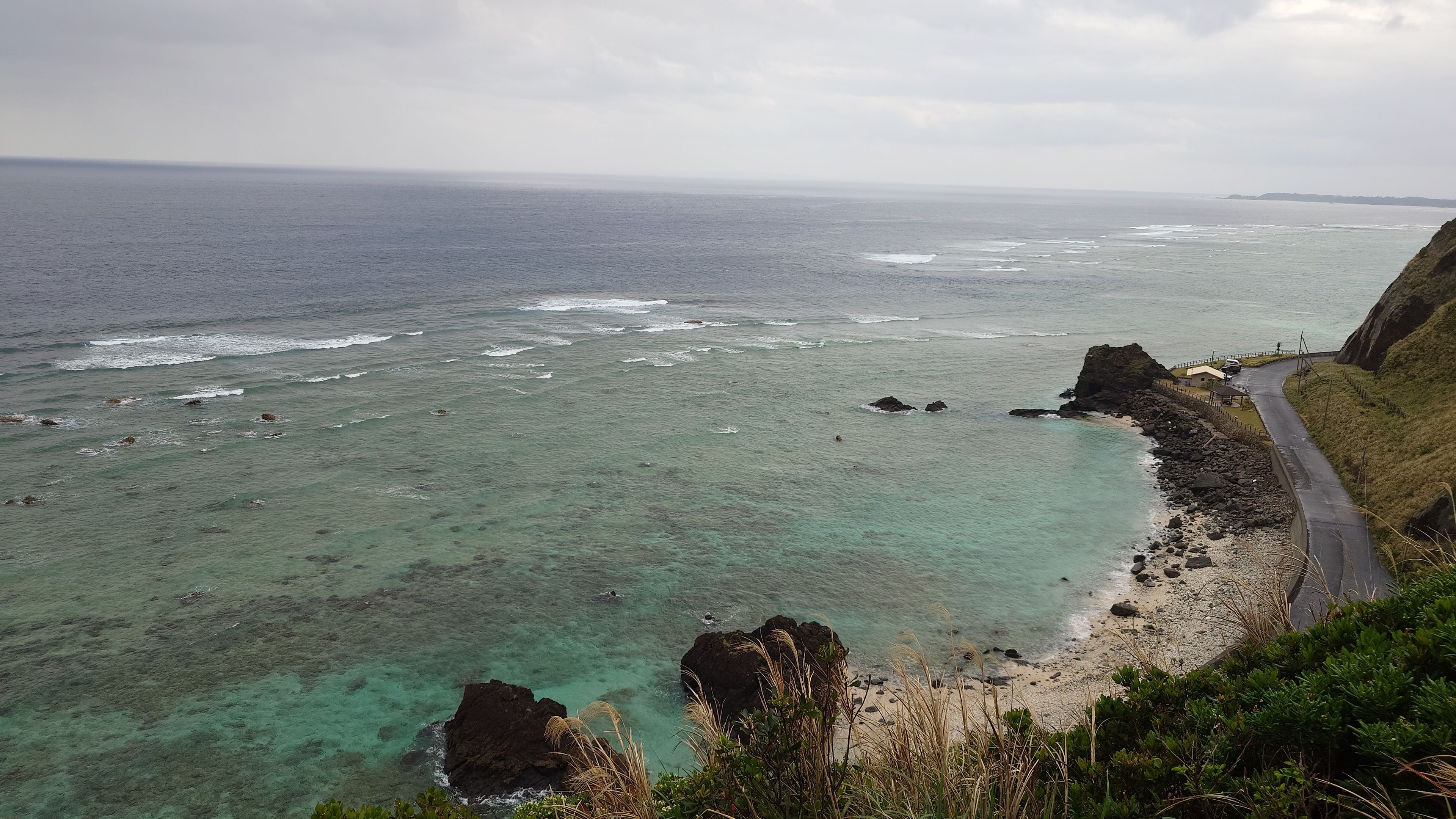
Tomori Beach
Despite its prime location just a 10-minute drive from the airport, the color of the sea is in a class of its own. The gradient, often called the "Blue Angel," creates an impression that will stay with you long after you leave the island.
💡 Travel Tips
🚻 Facilities
Toilets are available, but there are no showers.
There may be a simple foot wash area, but if you plan to swim properly, bring water in plastic bottles or plan to return to a nearby hotel.
🚫 Shops & Activities
There are no shops or marine sports shops.
It is a cardinal rule to buy drinks and snacks in advance. This is a beach for adults to quietly enjoy the sound of the waves and the scenery.
📍 Recommended Spots & Hotels Nearby
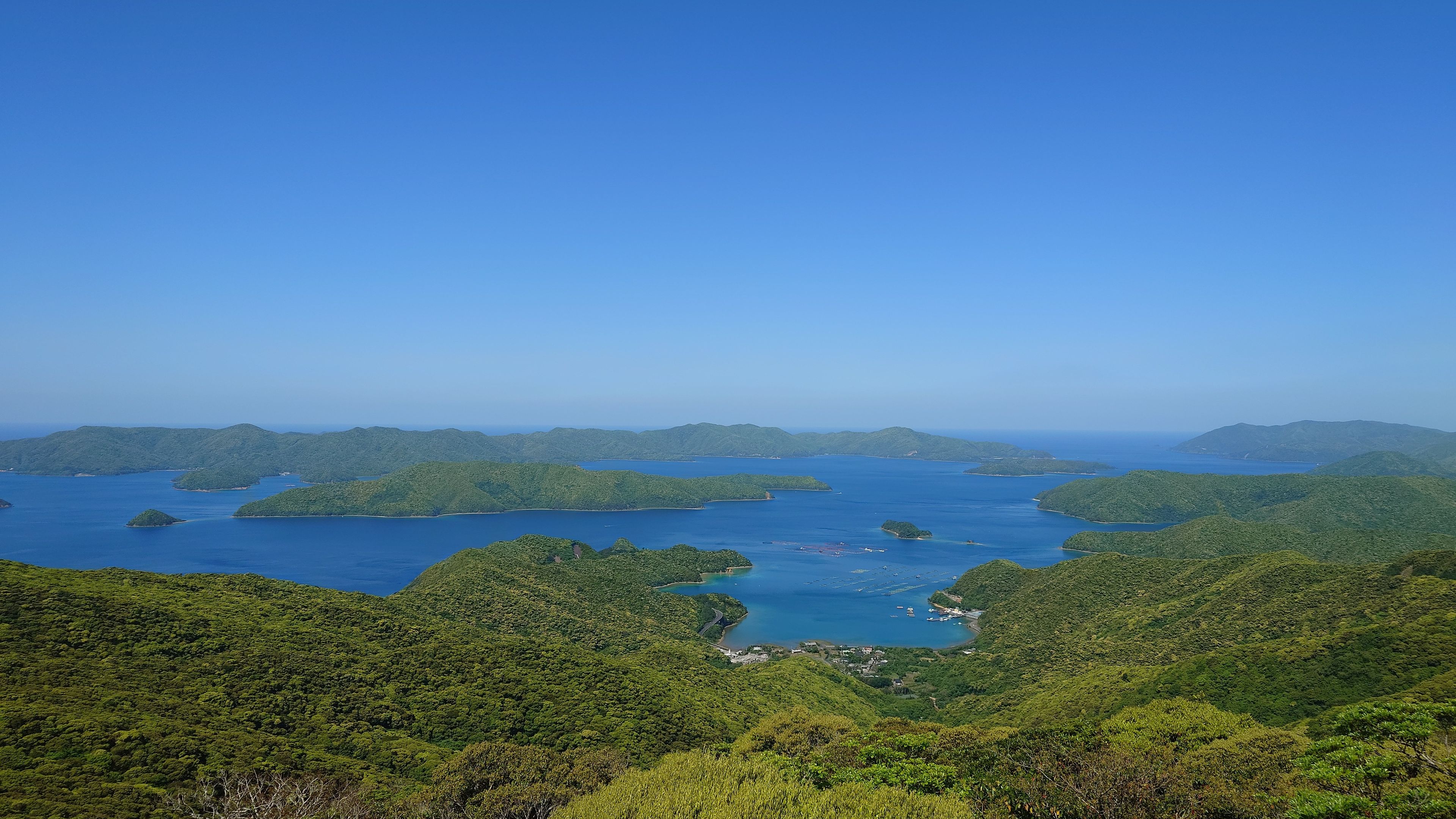
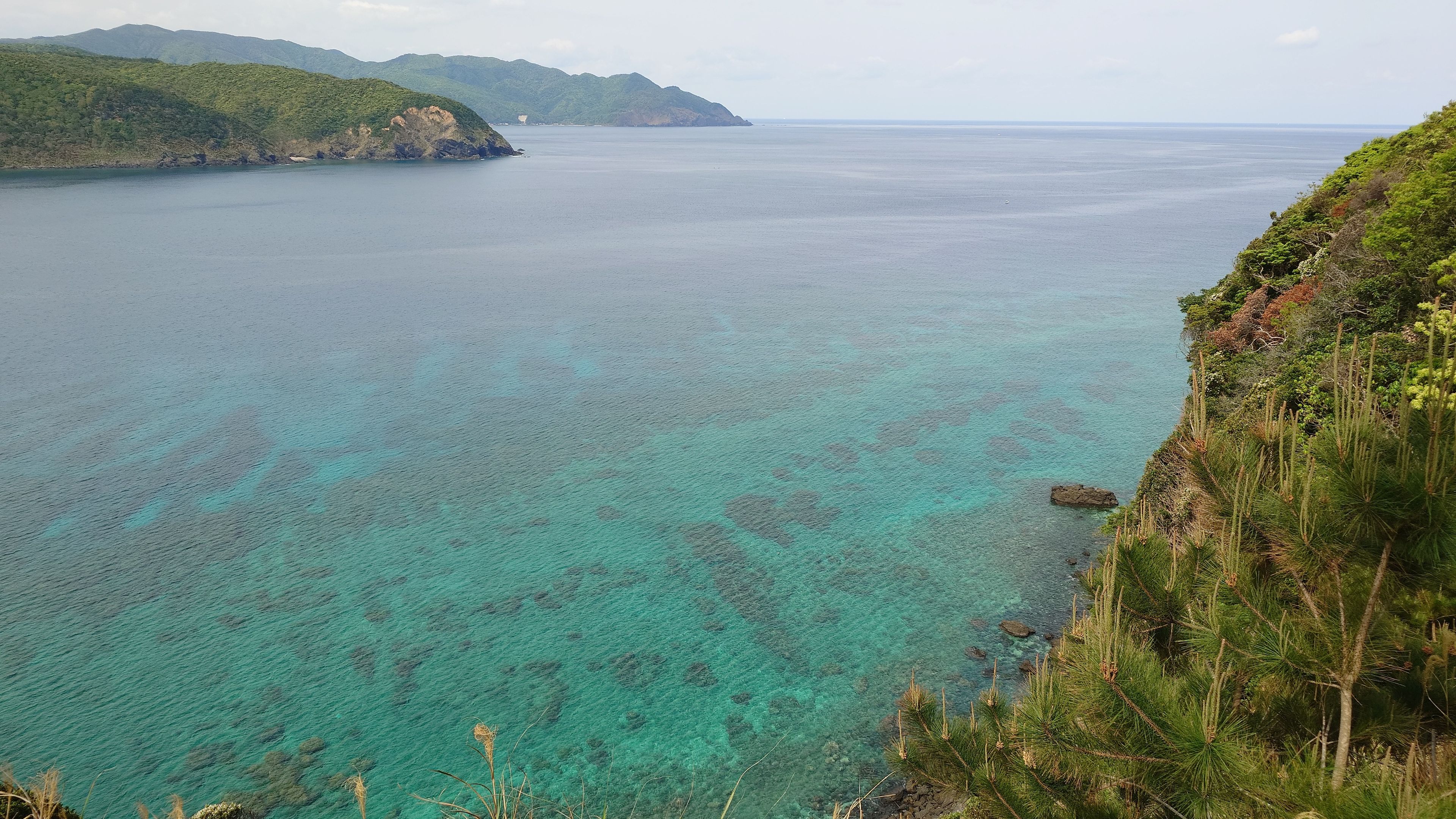
Kochiyama Observatory
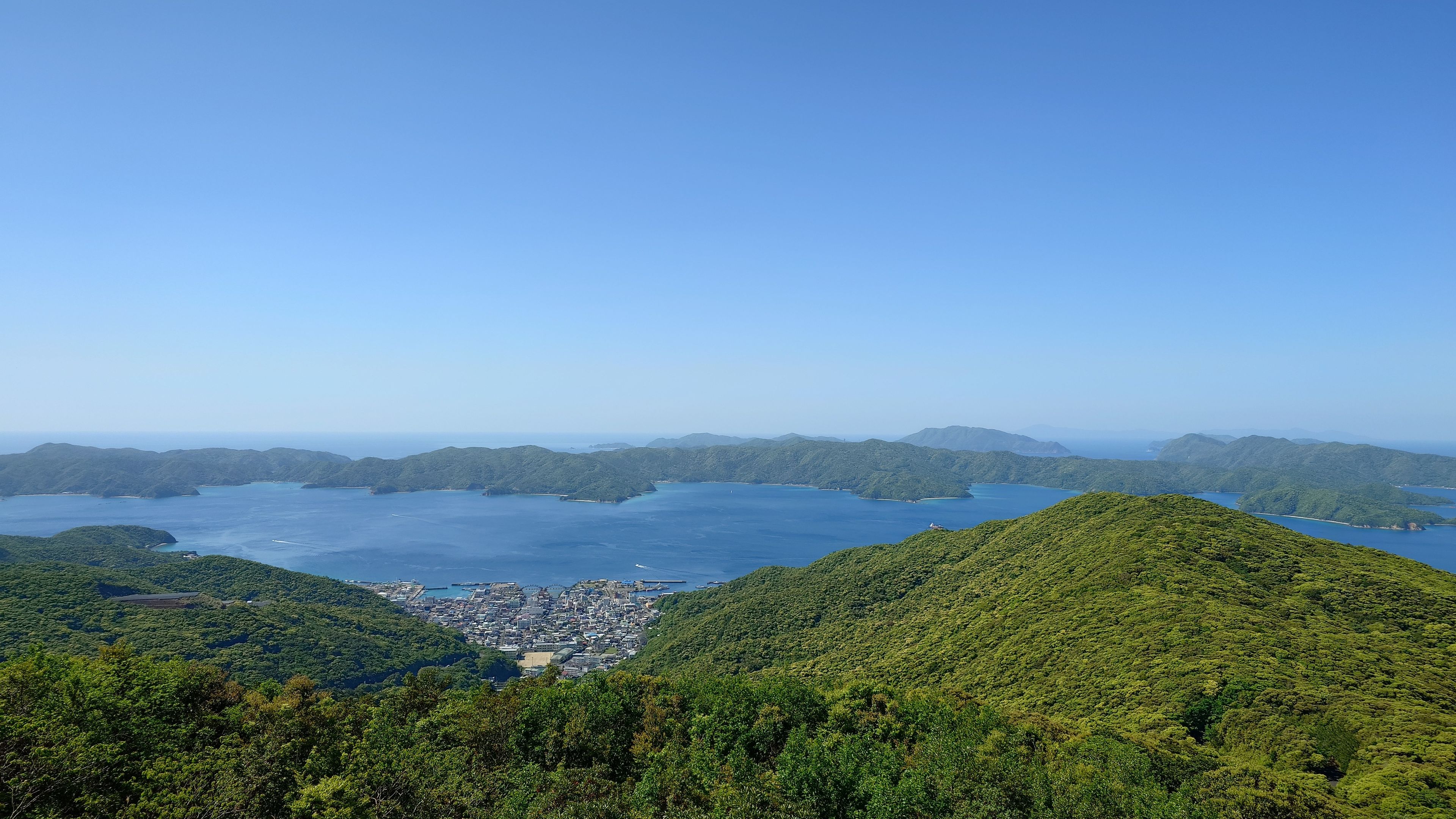
Deep in the mountain valley, Setouchi town below with Kakeroma island on the horizon
From here, you can see the complex rias coastline unique to Southern Amami, including the Oshima Strait and Kakeroma Island, as well as the many islands floating in the sea.
The sheer scale of the landscape delivers an awe-inspiring experience that no photograph can fully capture.
Yadorihama Beach
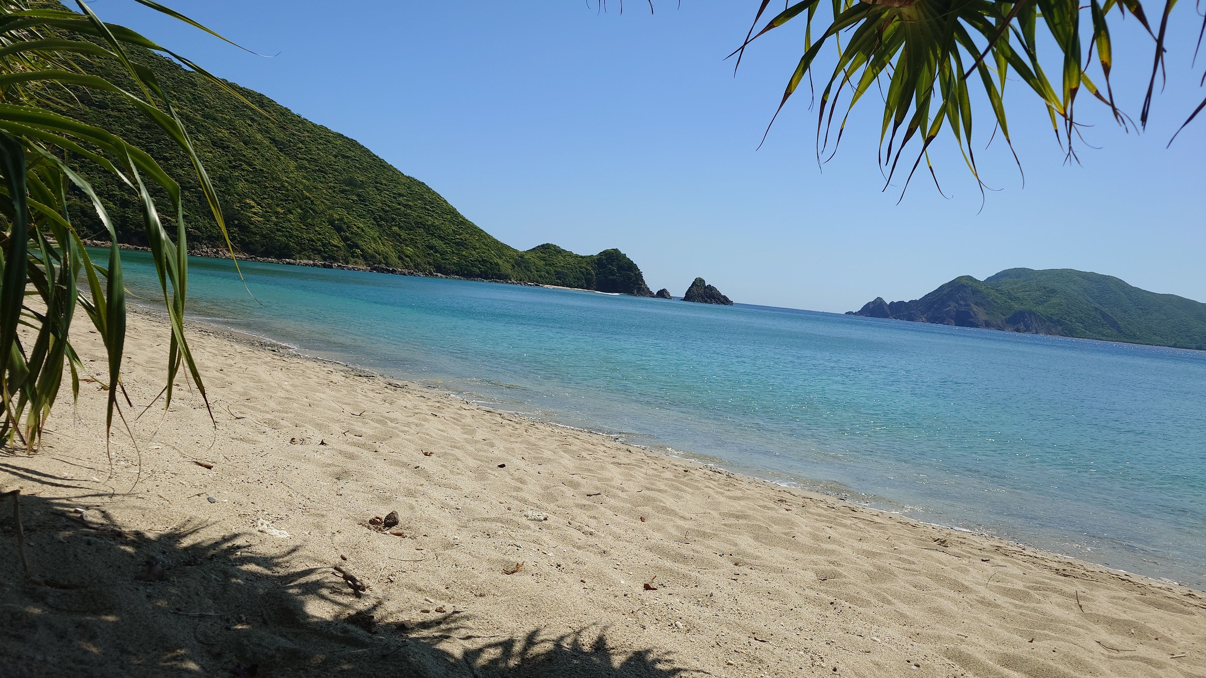
Subtropical plants grow thick at the edge of the sand, heightening the tropical atmosphere of Amami.
On the way to Yadorihama, glimpses of emerald green sea through the trees build anticipation before you even arrive.
Among those few, Yadorihama has a definite presence.
Subtropical plants grow at the edge of the sand, creating a vivid contrast between the lush green backdrop and the Amami Blue sea in front.
With showers and toilets available, the environment is well-equipped for those who want to jump in and swim.
The drive to Yadorihama is also a highlight.
Glimpses of the emerald sea through the forest along the way build excitement. We recommend driving slowly and enjoying the journey.
💡 Travel Tips
🚻 Facilities
Both toilets and showers are available.
You can arrive fully prepared to swim.
🚗 Parking
There is no formal parking lot.
A natural space has formed between the road and the mountainside in front of the beach, accommodating about 10 cars. Try to arrive early during busy periods.
Ayamaru Cape
The reef-lined coast appears brown from a distance, but the blue of the water as you descend to the shore is unexpectedly vivid.
The name "Ayamaru" is said to derive from the cape's topography, which resembles a traditional Japanese temari ball.
Maintained as a park, it is a place for locals to relax and an ideal spot to spend time quietly gazing at the sea. A cafe (Mishoran Cafe) is also on-site.
📍 Recommended Spots & Hotels Nearby
More Unmissable Views
Views of Amami found by running and walking.
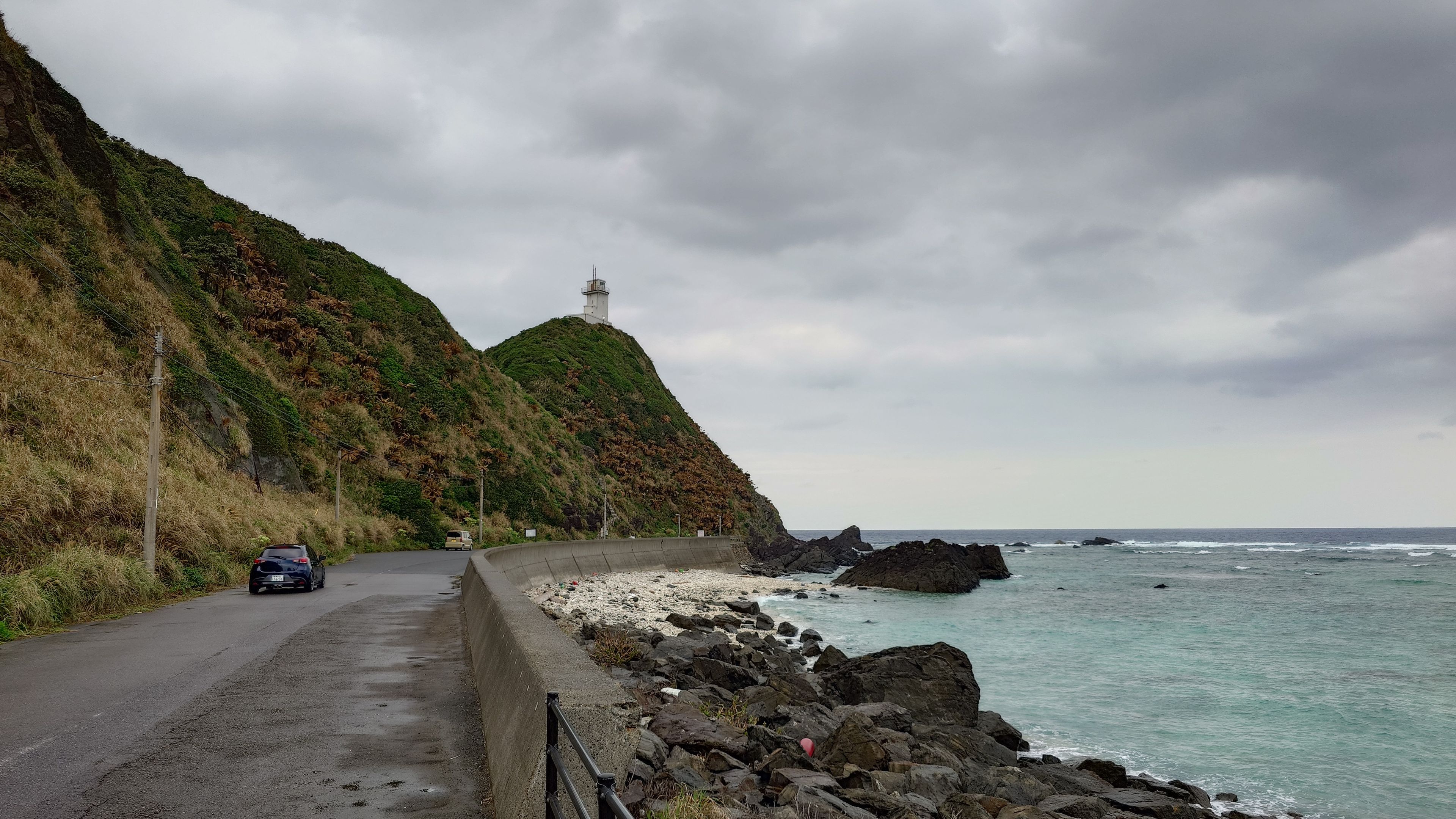
Cape Kasarizaki Lighthouse
The view of Amami's sea from the lighthouse base.
While you cannot enter the lighthouse itself, nothing obstructs the view of the horizon from the base.
On the day I visited, it was cloudy and the sea was nearly lead-colored. Still, something about standing at the very edge of the island kept me rooted in place. The Amami Blue on a sunny day must be exceptional here.
Parking and toilets are available.
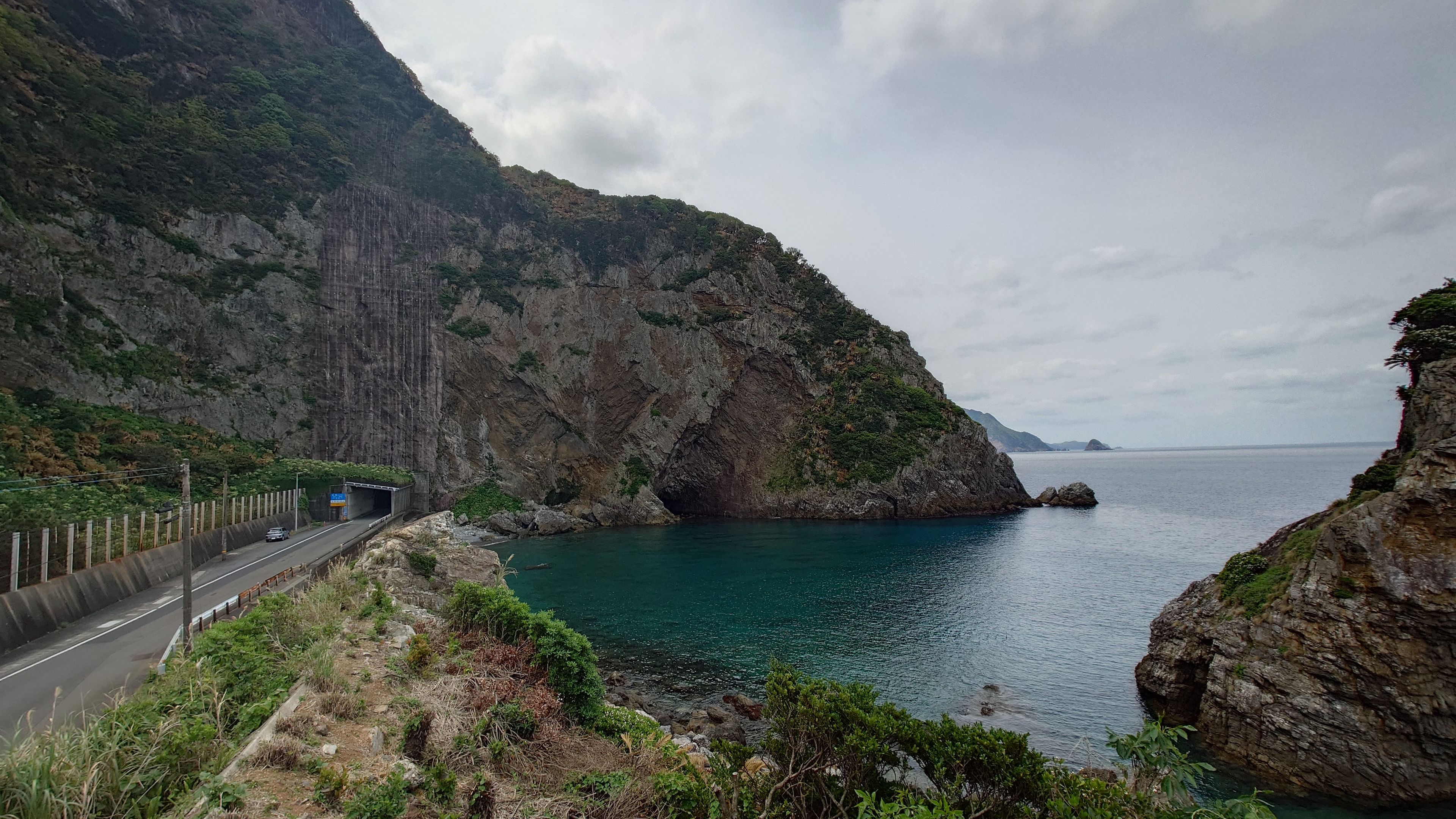
Dokubama Cliff
The raw rock face is exposed right by the road, making you instinctively pull over. Looking up, the top of the cliff cuts into the sky.
The viewing point is right next to the cliff, offering the only angle to capture the entire face. Deep, cave-like depressions run vertically down the cliff, with a quiet cove continuing to the right. Rough rock and calm sea coexist within a few dozen meters.
Parking space available on the shoulder.
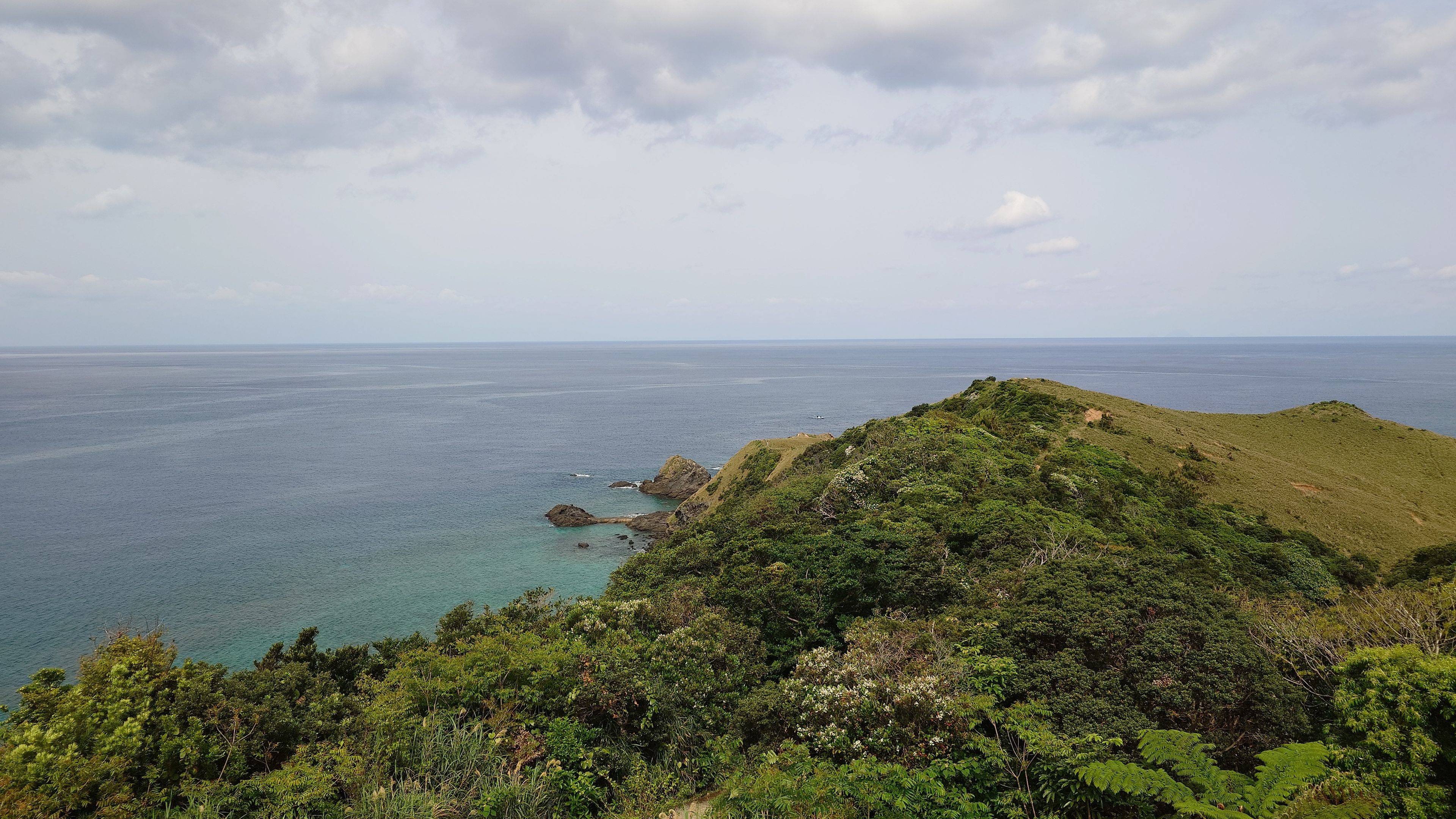
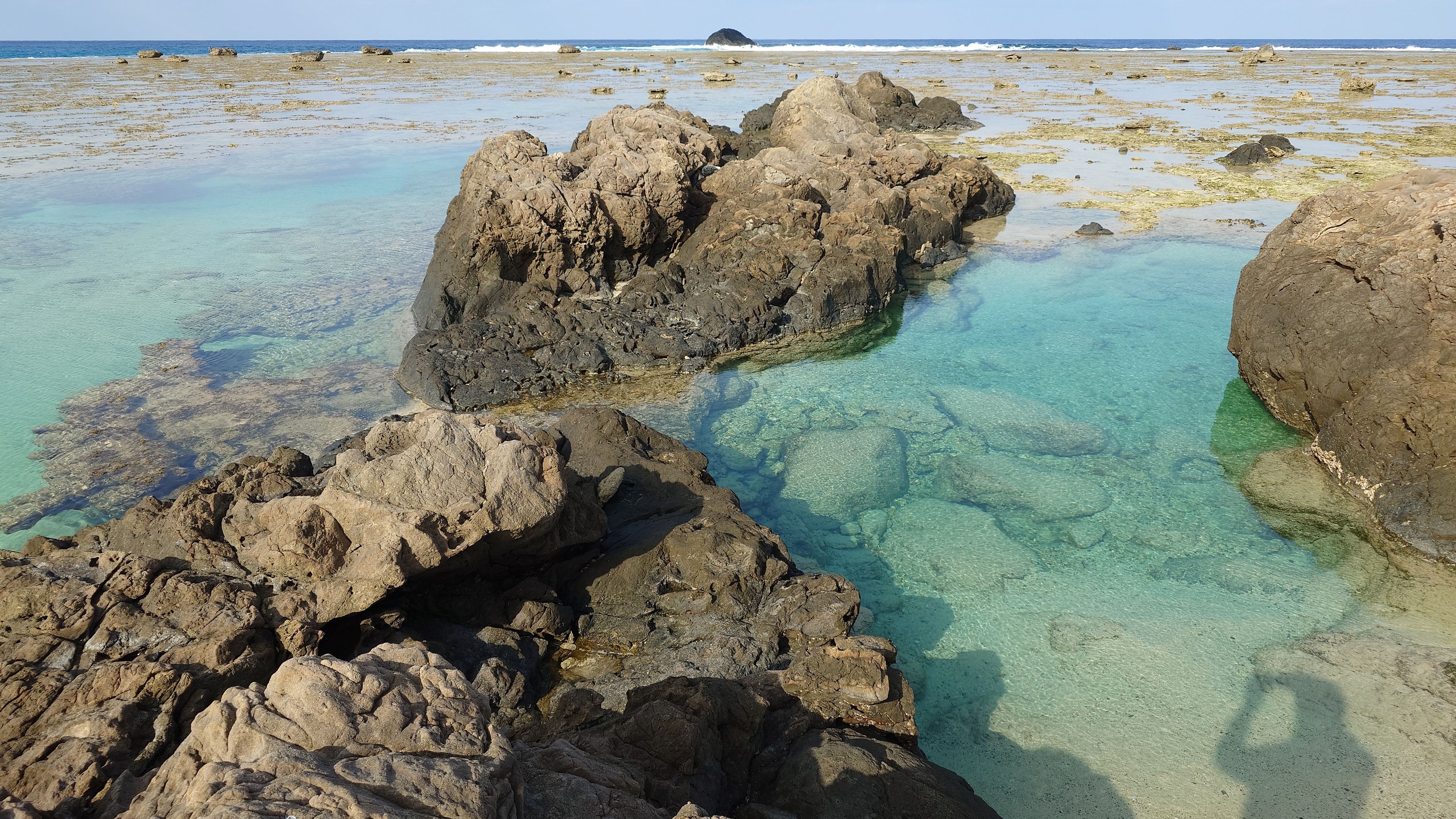
Miyakozaki Cape
Looking down at the emerald green sea from the cliffside.
There are no steep slopes that shorten your stride, but sneakers are more reliable than sandals. Water is essential.
Along the way, the subtropical vegetation on both sides constantly shifts the view. Every time the dense green breaks, the Amami Blue peeks through, only for the green to close again. This rhythm of green and blue makes the wide-open view at the tip all the more breathtaking.
Sea on both sides, green covering even the cliffs. You finally understand why Miyakozaki is so highly praised.
Parking available. Toilets at the observatory can be hit-or-miss, so it's best to use one beforehand.
Truly Delicious Amami Island Cuisine
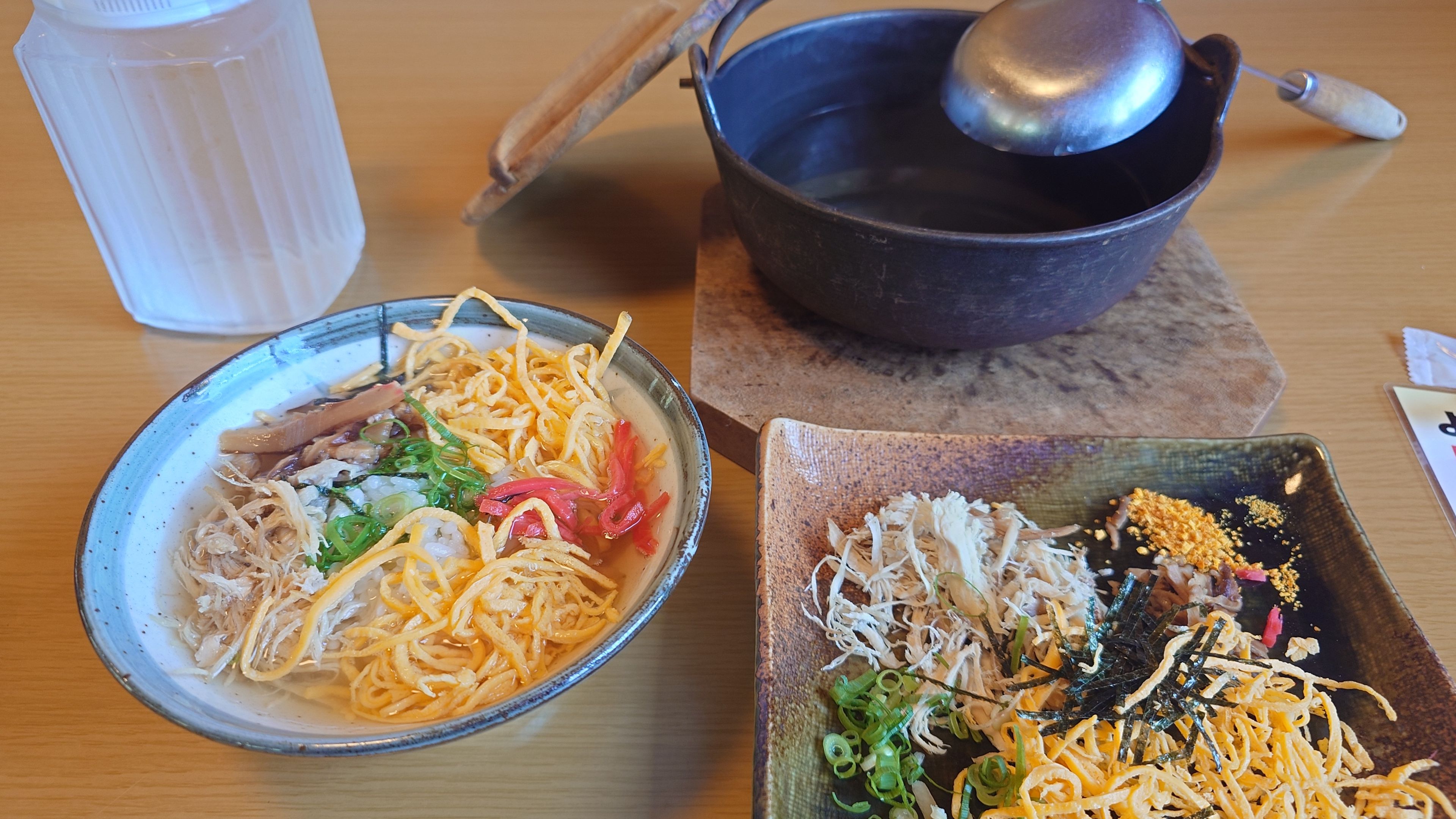
Keihan Hisakura
KeihanConveniently located on the way from the airport to Naze city, it’s highly accessible. While Keihan is the classic, the “Chicken Sashimi”, which can only be served because the chicken is so fresh, is a delicacy you must try.
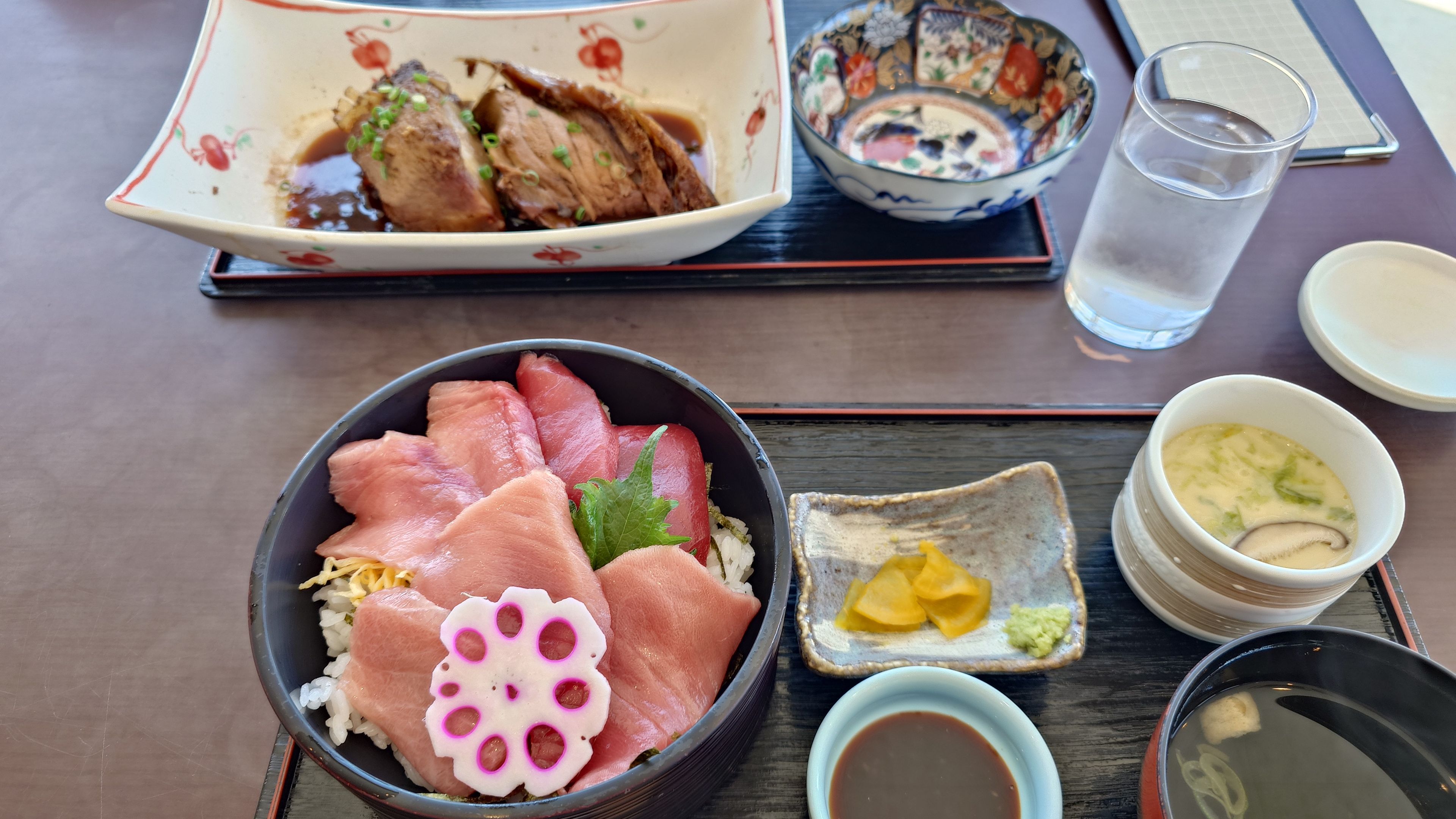
Setouchi Umi-no-eki / Seafood Restaurant
SeafoodThe “Simmered Tuna Collar” is particularly recommended. Beloved by locals for its incredible value and generous portions, it’s perfect for a lunch while waiting for the boat to Kakeroma Island or during southern sightseeing.
Uken Shokudo
Set MealA reliable spot for quality set meals in an area where it’s easy to become a “lunch refugee.” Ideal for a relaxing break during your drive.
Amami Oshima Travel Guide
✈️ Getting There
Direct Flights from Major Cities
Haneda, Narita, Itami, Kansai, Fukuoka, Naha, etc.*LCC (Peach) is also in service
☀️ Best Season
Whale watching is available in winter, but summer is the best season.
🌙 Duration
💰 Budget
🚗 Transportation
Amami is the second-largest remote island after Okinawa Main Island, and it takes over 2 hours to drive from one end to the other. A car is indispensable for free exploration.
⏰Rental cars go fast — reserve yours early
🌊 マリンアクティビティの予約
Snorkeling, mangrove canoe tours, and stargazing tours fill up weeks in advance during peak season (July–August). Lock in your dates at the same time you book your hotel.
▼ Check availability & prices (subject to change)
⚠️ Important Notes
- ⚠️Rare animals like the Amami Rabbit appear on night roads.Drive particularly carefully and slowly at night to prevent roadkill.
- 📍Streetlights are extremely scarce outside the Naze city area. Avoid long-distance travel on unfamiliar night roads and plan to arrive at your accommodation early.
FAQ
Do I need a rental car to travel around Amami Oshima?
How many days are needed for sightseeing?
When was Amami Oshima registered as a World Natural Heritage site?
How is the access to Amami Oshima? How long does it take from Kagoshima?
What is the best season to visit Amami Oshima?
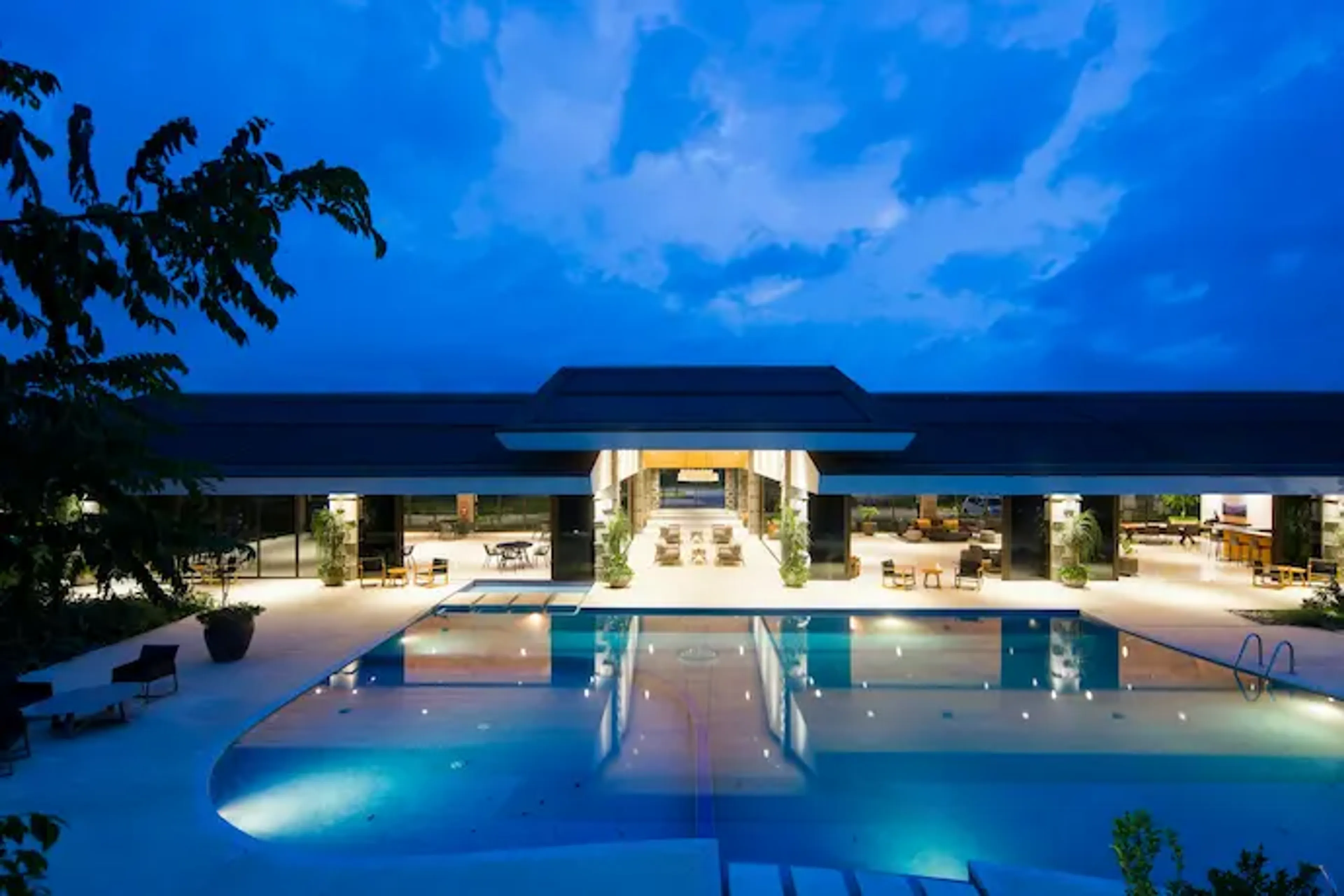
The Ultimate Island Time
in Amami Oshima.
From budget-friendly stays in Naze City
to luxury beachside resorts.